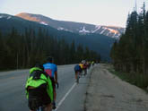
 Road out of Winter Park. Pass ahead
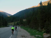 Sight of first switchback and ramp from Winter Park
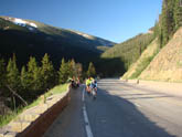 Climbing on the Winter Park side
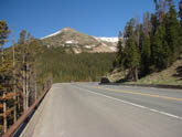 Wide roads below summit on Empire side.
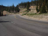 Nearing Summit
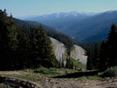 Stacked Switchbacks on Empire side
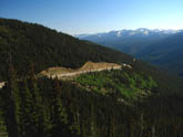 View north from summit area
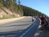 Climbing on lower switchbacks, Winter Park side
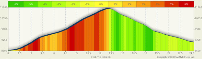
Berthoud Pass Summary
For the longest time, I avoided this pass. Having driven it on my way to Winter Park, I had memories of narrow roads, no shoulders, no guard rails, and heavy traffic. Well, I couldn’t have been more wrong. Substantial road works over the years have turned this into a marvelous pass, nice and convenient to Denver. Wide roads, good pavement, and awesome views now await those desiring a first rate climb.
Both sides of this climb offer twisting and winding roads. However, the switchbacks on the south face are a little sharper. There are five switchbacks and a sharper curve on the south side. The grades on both sides are fairly mild for a Colorado pass because this is a major commercial route and, as such, a lot of digging was done to keep the grades acceptable to trucks.
For riding, I actually prefer the north face as it is a bit shorter and the roads are good, and it’s very scenic. There are four switchbacks and four sweeping curves to keep your attention. The South face has very wide very smooth roads, but the steepest parts are on the switchbacks, meaning you have to watch your speed. The sad thing is, unfortunately, the infestation of the pine beetle. In 2008 and 2009, I witnessed the destruction of the trees in Summit County and, sad to say, this part of the world is also impacted. Many of the once green slopes are now covered with dead or dying pine trees. The mountains still inspire awe, but the brown patchwork of dead trees is simply sad.
From Empire (about two miles off of I-70) the road is fairly straight and the grades are only in the 3% range. This is a good warm-up for the climb which really starts with the town of Berthoud Falls. From there, it’s up, up, up. The grades rarely exceed 5.5% on this side and you pass some great road engineering feats. Toward the middle of this climb you will come upon four switchbacks that have the road stacked on itself. This is the most difficult section and it’s not that bad. After the forth switchback, it’s only another miles and a half to the top and only about a 600 foot gain.
The north face climb (or descent) is steeper at the top and at the bottom and more moderate in the middle. That could be because the switchbacks are at the top and the bottom! A few steep switchbacks at the top, followed by a nice steady steep ramp, and a couple more switchbacks at the base. In fact, a lot of the elevation gain on the north side is actually at the base. It’s kind of fun to step to the side of the road and look back at the twisting roads below you. The run-out to Winter park is smooth and gradual, averaging only in the 3% range and making for a great way to coast into Winter Park for food and rest.
This is a great pass for beginners as it is not that difficult, is very scenic, has great roads, and is fairly short.
Alternate Routes
This is really an out and back pass. One can easily do a round trip from Empire to Winter Park and back for a roughly 50 mile day. This pass is also a good training hill for both climbing and technical bike handling.
If you wanted to add this as part of a tour, it is positioned nicely as both a front slope climb with easy access to climbs like Mt. Evans, access to Rocky Mountain National Park, and as a gateway to Granby and northwest Colorado.
In addition, this is a great link to Summit County, Loveland Pass, and out toward to Vail Pass.
In fact, a realistic and fairly easy four day loop ride could have you starting in Idaho Springs and riding to Frisco via Loveland Pass. Loveland from the I-70 side is only a four mile climb (yes, it’s also a big climb from Idaho Springs, but it’s not bad) to the summit. Come screaming down into Keystone, Dillon, or Frisco for the night.
From Dillon, a nice, mostly flat ride to Kremmling. From Kremmling, a shot east through ranchlands and canyons to Granby and then from Granby back to Idaho Springs over Berthoud.
A route like the above will get you a nice taste of what Colorado has to offer and won’t over tax you. The longer days are fairly flat and the shorter days have some nice climbs.