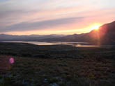
 Intersection of CO 40/134 at sunrise
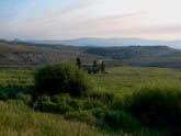 Approx 6 miles west of CO 40 during climb
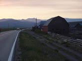 Ranches along CO 134 before start of significant climbing
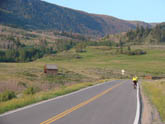 View about 4.5 miles from CO 40 looking at start of material climbing
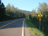 Aspen forests on CO 40 side of climb, approx at mile 9
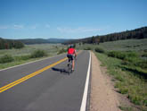 Flat valley between east and west summits (about mile 15)
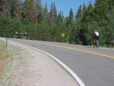 West summit high point marked only by "downhill" sign
 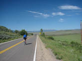 Runout on Tonopas side of pass. Runout is fast and flat (about mile 23)
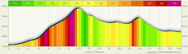
Gore Pass Summary
If you’re looking for a ride that gets you away from it all, this is it. I love this ride as it starts in the middle of nowhere and ends in the middle of nowhere. It goes through some fantastic countryside and is a fairly easy climb at relatively low altitudes (at least for Colorado).
This pass has some similar attributes as Rabbit Ears, as it’s about the same height, has two summits separated by rolling meadows, and is through Aspen forests and high alpine meadows. But there are a few differences; one of the most significant is the almost total lack of people and cars. Chances are you won’t see many, if any, cyclists and car traffic will be very very limited. As such, this could be a nice family ride. Be cautious, however, the remoteness also causes issues if you break down or need medical assistance. Help will be a long time coming and it’s a long walk to nowhere. Bring a basic flat repair kit, basic tools, food, extra water, and a cell phone (which may or may not work).
A gGood starting points for this are CO 40 and CO 134 on the east side and CO 131 and CO 134 on the West. The entire ride is on CO 134. From the East, the first five miles have you doing a slight climb through private ranch land following Pass Creek. The short hill at mile two will get your legs warmed up good as you ride around a rather large bump in the ground. A sign indicating six miles to the summit marks the point where the real climbing starts (five miles into the ride, and the grades jump from 2% and 3% to 6%+ for a mile). While the maximum grade is 7%, this never really is a hard climb. The lower altitude provides a fair supply of oxygen (but remember, you are still in the mountains), and the climb grades fluctuate in the 3.5% to 5.5% range with the steeper climbs at the base and toward the top. A two mile segment mid way through the climb give you a bit of a reprieve as the grade backs off a bit.
One thing you will note during this climb is that there are no breathtaking panoramic views. Instead, you are treated to a ride through the Arapaho National Forest. You don’t see mountain peaks, you see aspen, aspen, and pine trees. The road has some gentle curves between miles eight and ten, but other than that, it’s more or less a straight run. The summit is also a little different. There’s no vista, no views of Kremmling, just more trees and bright Colorado skies. There’s also a campground up here back in the woods.
Once you summit, you give up about 400 feet of altitude in a short downhill run. The nine miles of rolling terrain between the two summits is spectacular. Riding through the Routt National Forest, you are surrounded by a spectacular green valley crisscrossed by streams, creeks, and ponds. This area looks like a sportsmen's paradise. The climb to the west summit is fairly easy and short at about a mile. The descent to CO 131 is pleasant and not overly steep. The last eight miles is virtually flat and you’ll likely have a cross-wind here.
The west side climb is easier than the east approach. You are starting 700 feet higher in elevation. The first eight miles are virtually flat with a very slight upward tendency. The remainder of the climb ranges between 3% and 5.5% with a very short 7% grade at the very top of the west summit. Traffic will be light as you leave the west slope ranchlands.
This truly is one of Colorado’s undiscovered gems and an all out great ride. Everyone I know who has ridden this pass just loves it.
Alternate Routes
I usually like to mention other rides in the area or alternate routes here… but in this case, there are really no alternatives. I told you before, you are in the middle of nowhere. OK, you can skip Gore and do the Muddy Pass/ Rabbit Ears combo, but then you’d miss this point of this ride. Instead, let me suggest some alternatives to get to Steamboat Springs. If you ride Kremmling to Steamboat via Gore, you are looking at roughly 75 miles. There are two fantastic ways to get to Steamboat: One through Oak Creek and the other through the Stagecoach Resv. state forest. Oak Creek would be the heavier traffic route, but it does give you some nice little climbs into steamboat and gives a nice downhill just outside of town. Stagecoach, however, is much less traveled, has some nice long mild downhill grades, and does have a few short but steep climbs. Either way, if you decide to go to Steamboat, you’ll like both options.