Grand Mesa Profile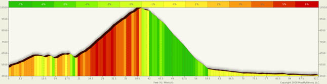

Grand Mesa Summary
Let’s see, Mt . Evans, Trail Ridge Road, Slumgullion/ Spring Creek Pass… three of the four hardest and must do climbs in Colorado. The fourth must do climb is none other than the Grand Mesa. Don’t be fooled. This is one long and relentless climb from either side. Starting in Cedaredge, it doesn't look imposing. It looks like little more than a bump in the ground. It’s not. The grade from Cedaredge looks flat, but it’s really in the 3% range and the constant drain on your energy is apparent.
Be prepared for this ride… there are little to no services between Cedaredge and Mesa… a distance of some 50 miles. Bring water and bring food. Also, you are starting at roughly 6000 feet in Cedaredge and are going to almost 11,000 ft. It can be very hot at the base and will be quite cool at the top.
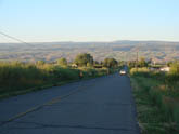
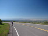
From Cedaredge, as you climb, you get an incredible view of the valley below you.. You actually get the feeling you are looking out an airplane window as you move on. You are in the open and in the sun and wind and you are absolutely free. If you like to climb, this is for you. This really is just a straight forward climb. As you move straight forward, you climb. Many climbs in Colorado have nice little breaks that let you catch your breath. Not this. A riding friend earlier this year coined the phrase “Only in Colorado can a 3% climb feel like a downhill.” The climb is relentless and when the 5% and 6% do back off to only 3%, it’s truly refreshing...
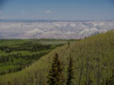
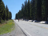
As you approach the top, you’ll start to come across more and more aspen and pine forests and lakes…lots of lakes. It’s a sportsman’s paradise up there and a world worth exploring.
On the Cedaredge side, the Grand Mesa resort is about the only developed rest stop and you can get some water and snacks. On the I-70 side, Powderhorn Resort is roughly half way up and you can get water if it's open (don't count on it, however).
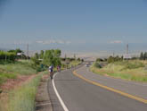
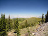
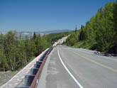
Also, please note, the average route grade on this side is only 3.2%. The primary reason for that is the long relative flat between I-70 and the town of Mesa. Take out that 12 mile section and you end up with closer to a 5% average climb. Once at the top, it’s all downhill… both directions. Be sure to take time out to look at the views. The pull-outs and vista are stunning.
Utah is visible on the horizon, and Colorado is below you. Enjoy the descent, there are not too many places in this world where you can enjoy good roads and a wonderful 20 or 30 mile downhill. I easily hit speeds in the high fifties flying down the I-70 side earlier this summer. Only gusty winds prevented me from opening up even more.
Enjoy (and carry extra water).
Alternate Routes
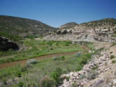
Anyone looking at the elevation map will see that it includes much more than just the Grand Mesa climb. It’s actually the elevation map from a century ride I took this summer between Hotchkiss and Grand Junction, courtesy of the Bicycle Tour of Colorado.
If you are doing a point to point ride, this is actually a great ride and worth considering Hwy 92 to 65 through Cedaredge is a reasonable route but can be high traffic. You can actually meander through the back country roads between Hotchkiss and Cedaredge by zig zagging through orchards, pastures, valleys and bluffs. It’s a spectacular route. In Short, it’s Hwy 92 out of Hotchkiss, north on 3250, west on L, north on 3100, west on North rd, north on 2700/Rimrock, then west on Cedar Mesa Rd into Cedaredge. There’s lots of climbing in there and it is simply beautiful. On the I-70 side, you can take 65 all the way to I-70. You go through a magnificent canyon with rock overhangs that make you cringe. It’s desolate and a certain way to get away from it all. You will need to take a brief ride on I-70 westbound to the Palisades exit as you leave the canyon and follow the Colorado River toward Grand Junction. You’ll only be on the interstate for a few miles and you just need to stay on the shoulder. You will pass one exit, so be careful of merging traffic.