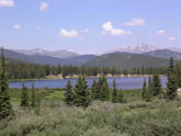
 Echo Lake, Mt Evans Access
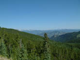 Bergen Park/ Evergreen side of climb
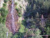 Idaho Springs, Waterfall and water wheel
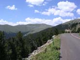 View of Mt Evan from Junniper Pass
 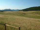 Start of ride out of Bergen Park/ Evergreen
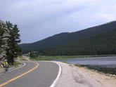 Echo Lake from Idaho Springs
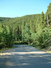 Climb up Juniper Pass
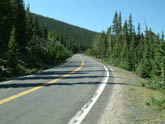 Climb up Squaw Pass
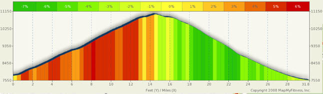
Squaw/Juniper Pass Summary
LoremNote: See Alternate ride on page 3 for a Colorado classic lung and leg busting 30 mile non-stop climb with a 7,300 foot elevation gain.
Squaw and Juniper Passes are actually north-south passes that you cross from east to west. So, why does that matter to you? Well, it’s because as you “cross” these passes going west, there is no descent… Only one long continuous climb. You are riding along the ridgeline of a few mountains rather than over them.
Leaving Bergen Park on CO 103 you are greeted by a gentle climb, wide open roads, meadows, and absolutely no clue as to what is ahead. You are screened from views to the west by a high treeless ridge. Within a mile, your climb really starts and you are immersed in a sea of green forests, twisting roads, and a relentless 4% grade.
For most of this ride, you will be climbing at a4% to 5% grade. While there is a maximum 10% grade just shy of Squaw pass, it is short. The lower section of this ride has a few rollers, but the “down” side of the roller is really more of a reduction in the grade rather than a downhill coast. You’ll find Squaw pass around 8.5 miles, but don’t look for signs or a downhill, you won’t find them.
What is amazing about this climb is that you really don't realize that you climbing to the clouds until you get to mile 13 of the ride when you can finally see around Chief Mountain. At this point you are only a couple hundred feet below 11K, but are still surrounded by heavy and thick forest. After this, you can really start to see some of the serious altitude that you have gained and you really begin to feel the altitude. You can also see the road in the distance as ramps up to Juniper Pass.
Just about mile 15, as you traverse around Warrior Mountain, you find Juniper pass, just slightly below the trip high point at 11,130 Ft. This pass is marked, but since you are already heading slightly downward, you, more than likely won’t want to stop. Also, since CO 103 is a rather narrow shoulderless road, you most likely won’t have a chance to safely stop. Juniper Pass marks the end of your climbing day unless you are planning to try Mt. Evans. From here, it’s a fifteen mile joy ride down to Idaho Springs.
If you start this ride in Idaho Springs, you will be treated to a lot more traffic and roads with steeper and sharper curves, Especially about 8 miles out of Idaho Springs.
The first 8 miles follow Chicago Creek in a canyon/valley setting. The landscape rises sharply on both sides of the road, but the road remains at a rather timid 4% to 5% or so grade. Beyond mile 8, you take a decided turn upward and you can see the road above you winding it’s way along the mountainside. You are about seven miles shy of Echo Lake here and you have quite a bit of climbing to do.
You hit Echo Lake around mile 14 and it’s a great place for a stop and rest. There is a restaurant/snack bar for your enjoyment. Juniper Pass is a mere three miles ahead with a remaining climb of about 450 feet. Of course, for those of you wanting more of a challenge, a right turn here heads you up Mt Evans, 14 miles in the distance.
Alternate Routes
If you are looking for a climb of a lifetime close to Denver, then here is. From Bergen Park to Idaho Springs it’s 31 miles and 3,600 feet of climbing (either way). It’s basically 15.5 miles up and 15.5 miles down. What makes this a climb of a lifetime is that if you hang a left at Echo Lake (a right if you started in Idaho Springs), you can add another 3,700 feet of climbing and 28 miles (round trip to Mt. Evans)of distance to this ride. Bergen Park or Idaho Springs to Mt Evans is roughly 30 miles of almost non-stop climbing with about 7,300 feet of elevation gain. Talk about a leg busting, lung busting challenge… you found it.
Don’t take this trip lightly. Have extra water and be acclimated to altitude. Riding above 12,000 is far more difficult than below 12k. And this route takes you to 14k. It’s well well worth it.