Mt Lemmon, AZ

Last update: 01/2010
Fact Table:
| Location | Tucson, AZ |
|---|---|
| High point | 8828 ft |
| Max Grade | 9% |
| Route Distance | 27.8 mi one way |
| Elev Gain | 5650 ft |
| Rating | Difficult |
| Access City | Tucson, AZ |
Ride Tips:
Very remote with little to no services. Bring food and water
Restrooms at campgrounds and some pull outs
Temps at top and bottom vary greatly. Top could be quite cold
Carry foul weather gear, particularly in winter months
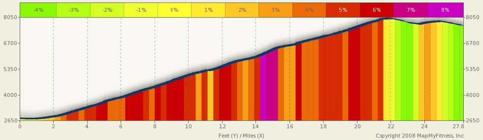
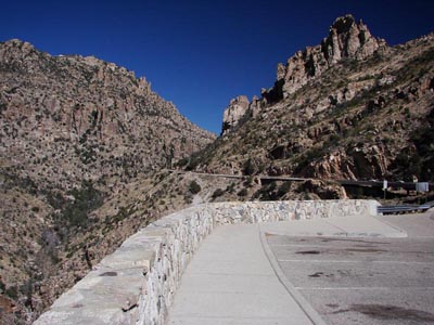
Mt Lemmon is a monster climb. Almost 28 miles long and 5600 feet of climbing. It’s hard to find that combination in Colorado, and yet, here is a more or less year-round climb in the middle of the SW desert. The starting point for this ride is the parking lot at the Roy Drachman Regional Park. For a shorter climb, there is a good pull-out 5.1 miles into the climb (from the park). The fee station is just under 8 miles into the climb, and Molino campground is just over 8 miles into the climb.
I found a pretty good description of the area itself at: http://azentertain.com/tucson/mtlemmon/information.html
I rode this climb in February 2009 and found it absolutely fantastic. Apart from the leg burning constant 5% to 6% grade, with a segment in the middle approaching 9%, the scenery was spectacular, the air crisp, and the views of Tucson and the Arizona desert simply amazing. You can take advantage the many pull-out for a rest and to take in the views. This is one incredible climb.
0 mi |
Start |
|
0.22 mi |
Turn right at E Roger Rd |
|
0.64 mi |
Turn right at N Soldier Trail |
|
2.11 mi |
Continue onto N Mt Lemmon Short Rd |
|
2.59 mi |
Turn right at E Mt Lemmon Hwy |
|
25.18 mi |
Continue onto N General Hitchcock Hwy |
|
27.37 mi |
Continue onto N Sabino Canyon Pkwy, travel to end and turn around |