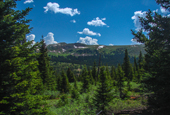
 Up Fremont Pass, near Copper Mt
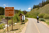
 Trail between Copper and Vail
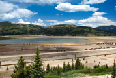 Tailing Pond, Fremont Pass
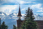 Leadville
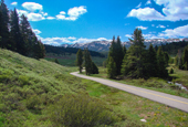
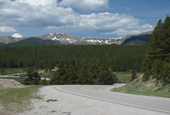 Road toward Tennessee pass
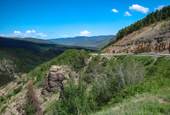
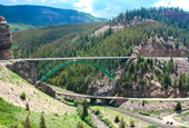 Battle Mtn Area
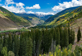 Vail
Vail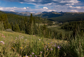 Vail/Shrine Pass
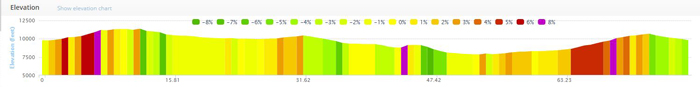
Copper-Leadvill Loop
I have done this loop many times and prefer clockwise: Copper-Leadville- Red Cliff- Vail- Copper. Yes, the climb out of Vail is big and at the end of your day, but it's a lot shorter than the climb from Red Cliff to TN pass if you took this in a counter-clockwise direction. Obviously, your choice... But, for me, the scenery on the Vail to Copper climb make up for the late day climb (you can enjoy it as you are going slower rather than screaming down the road). Counter Clockwise, your climb is close to 50 miles long from Red Cliff to Leadville (with a few short downhills).
The entire route is scenic, but don't be surprised at Fremont Pass. It's basically an all out strip mining location and on one hand, the mining scars are disappointing, but on the flip side, it's fascinating to look at and the tailing ponds have incredible colors. Also, after an 8 mile climb, the top flattens out significantly... You have a dip and additional climbs for about 5 miles before you summit. If going counter-clockwise and are looking for a typical downhills after yo summit, you have a while to wait until you pick-up some speed.
The TN pass climb out of Leadville is short and fairly easy. In fact, you head down from Leadville for a good portion of the climb. The TN downhill gets interupted twice: First, a several mile long flat stretch past Camp Hale National Historic Site, and then (in my opinion) an annoying climb up Battle Mountain. It's not a pass, but is a really big speed bump that tops out at about a 9% climp (actually getting a Cat 4 rating for climbs). Good news (unless you like climbing), this is a fairly short climb.
Up and down Vail pass is on the Ten Mile Canyon trail. It's about 20 miles long and the uphill is much longer than the downhill. This is considered a Cat 1 climb. Being a road biker, I don't typically like bike trails, but this is an exception. It's fantastic. You follow old Vail Pass road (closed to traffic) for a good part of the climb and then transition to a nicely maintained trail. It's fun, scenic, and rolling. Around mid-day, it could get crowded. Cycling from Vail to Copper, the trail is your only option- But you'll like it!
Have fun.