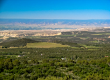
 View above Cedaredge, CO
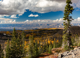
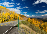 Grand Mesa in the fall
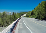 Road on north side of Grand Mesa
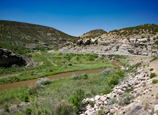 Canyon between Mesa and Palisade, CO
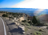
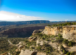 Colorado National Monument
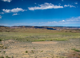
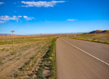 Western leg of ride- HWY 50
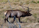 Local resident
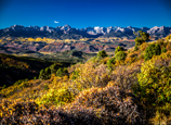
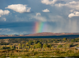 Near Cedaredge, CO
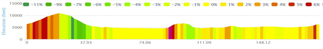
Grand Mesa-Grand Junction
Here’s a ride that has a little of everything: One of Colorado’s top three epic rides (Grand Mesa), a ride through Colorado National Monument (you must have a front and rear light on your bike through the Monument tunnels), a ride along the Colorado River, a ride next to (but not in) the Dominguez-Escalante National Conservation Area, and a trip through a remote area of moonscape desolation. The roads include county roads, paved bike trails, a short distance on Interstate 70 (cycling allowed at the short five mile stretch with very wide shoulders), an unavoidable stretch of Hwy 50 south of Grand Junction, the home of Colorado Palisade peaches (and apricots, cherrirs, pears, plums, etc). The route includes a Catagory 1 climb, cruising through a wide canyon, large western Colorado towns, ultra remote west slope ranchlands and desolation, and the beauty of the Grand Mesa and Colorado National Monument.
This is a 3½ season route as it can be done mostly year round with the following caveats: Winter can be a challenge as the Grand Mesa and Colorado National Monument could be closed for a while in winter due to snow. Einter snow and ice can impact the entire rest of the route, although it often does not stay around long. If going in the winter, plan well and prepare for bad weather. Also, the Summers on the western slope can be extremely hot, particularly between Palisade-Grand Junction-Delta. Think over 100 degrees. Sudden storms can spring up out of no where in the summer and spring cold snaps could be bone chilling into May. I’ve done this route, or portions of it, in late spring and early fall when temperatures are nearly perfect and, in September/October, the fall colors are spectacular. Always be prepared for changing weather and know, regardless of the above comments, the weather is seasonably great most of the year.
This ride can easily be modified based on your needs. I like a three-day ride starting and ending in Cedaredge with two nights in Grand Junction. Day one over the mesa, day two goes over the CO Nat Monument and day three gets you back to Cedaredge. If you want to do this in two days, it does not matter if you start in Cedaredge or Grand Junction as those would be the start/end cities (starting in Delta would leave one day far too long, unless you like ultra marathons and like remote camping).
A couple of route variations-
- Out of Grand Junction, I try to get you off Hwy 50 for a while by using County 135 and 145. It adds a bit of a climb and is a 15-mile detour. Ultimately, you are back on Hwy 50. Depending on what you want, you easily could reduce the trip by about 10 miles and avoid a climb just by staying on Hwy 50.
- Out of Delta, I suggest Trap Club Rd. Taking this side road allows you to avoid higher traffic Hwy 92 and 65 (both good roads) between Delta and Cedaredge. Trap road is about a desolate as you can get, and as such, I find facinating. If the moon were on earthm this would be it: moonscaped area, very remote, and has very little in the way of services. You get a flat or break a spoke or cable and you are on your own. It also runs through a large OHV (off-road/ ATV vehicle) area. While the OHVs can not ride on the highway, you’ll likely have trailer traffic to/from the OHV staging area. If this is not interesting to you and want to follow the same old mundane route, just stay on 92/65 and skip Trap Club road (it will add a few miles to the overall route).
- In the Monumment, I have a short out and back on D S Road. Nothing spectacular. Nothing overly scenic... But it is a bit fun and lets you see more of the Monument. Skip it if you want to shave a few miles of the ride.
- Finally, I take you from Grand Junction to Fuita on a bike path. The path is well maintained and follows the Co River. Personally, I like riding along the river. But for road cycling purists, it's a bike path, not a road, so you do have a few road crossing and can have little kids on trikes to deal with. To avoid the trail, simply take 340 to the north entrance of the Monument. It will shave a few miles off the overall trip as you don't head out to Fruita.
Finally, just be aware of large gaps for services in the route. Between Cedaredge and Palisade, there is not much in the way of anything. Mesa has a general store and there is a picnic area near the top. But on this leg, carry lots of snacks and water. My first time up this route, because of the relentless climb and heat of the day, I ran out of water about half way to the top. Don't let that happen to you. There is also nothing in the monument, between Grand Junction and Delta, and between Delta and Cedaredge... Just plan ahead. And,
Have fun!!!!