Route Summary
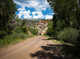
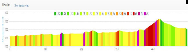
Here is a great alternative to the very busy Highway 6 between Dotsero, Gypsum, Eagle, and Wolcott. You’ll add about 30 miles to the Dotsero-Wolcott leg of your ride, but it is well worth it to be away from Highway 6, Interstate 70, and high traffic. NOTE: About 21 miles of this route is unpaved but very ridable on a road bike.
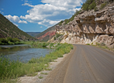
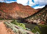
Colorado River Road
OK, let me give you the dirt first: from Dotsero, the pavement ends just past mile 16 and the road remains unpaved all the way to Highway 131, about 20 miles. For the most part, we are talking hard, hard, hard, hardpack with years of gravel chip pressed into the road. You can’t call this dirt anymore as the surface (as of August 27, 2017) is better than some of Colorado’s paved roads. Don’t take dainty sew-ups or racing tires on this road, but any 700x21 or wider road tire with tread (not slicks) should work well. I rode with Conti Grand Prix GP4000s II folding tires that had over 2000 miles on them and had no problems. Just stay toward the center of the road (the cleanest) and avoid the soft gravel shoulders. You do have loose gravel (watch your speed) to contend with in a few places (e.g. the climbs, like the mile 23 and the downhills).
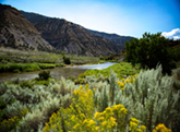
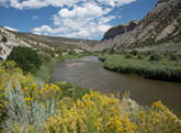
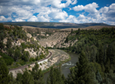
Overall, this is a neat little detour that takes you along the Colorado River as it winds it’s way from the Colorado high country to your washing machine in Arizona and California. For almost the entire ride, the river is at your side. There are a number of access points for rafting, fishing and even swimming along the way. For the most part, the current is reasonable (although it would be stronger and colder during the spring melt).
You are generally riding in a wide, shallow canyon and are riding at river level. In a few cases, you will turn away from the river and climb out of the canyon for nice views from the plateaus above. The climbs are not long or steep, but are enough to give you some good exercise. The biggest climbs are reserved for Highway 131 heading back toward Wolcott. These are where the ride gets it’s greatest elevation changes.
One unusual aspect of the ride is that you are often within a few feet of a passing coal train. The tracks run parallel to the River road and, at times, you can literally reach out and touch the train. There are a couple of track crossings and one cattle guard to contend with. The tracks cross the road at over 45 degrees, so be very careful your wheels don’t set sucked into the track (especially if wet outside). The cattle guards are typical and use care crossing them.
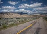
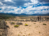
You are remote here. There are NO services, NO cell phone, and No humanity for most of the ride. It is quiet and rural. Horse Creek (mile 10.5) has an rest room. And that is about all you will find out there. If you want quiet and scenery… this is the place.